Portoscuso → Bacu Abis
Walking distance 19 km
Download Appy for the stage map
Stage information
- Ascent
- 1108 m
- Descent
- 1103 m
Difficulty: challenging
Walking the stage
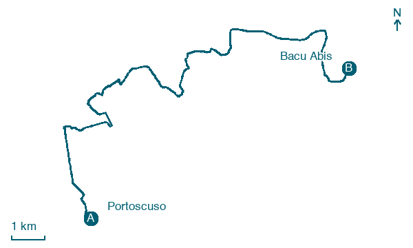
This walk of about 19 km follows the volcanic cliffs from Portoscuso past the Capo Altano pine forest to the Bacu Abis mine, where coal mining began in the Sulcis basin. It also passes the Seruci mine and the nuragic settlement of the same name, the ruins of the Church of San Rocco, and the Castoldi Palace.
Before leaving Portoscuso, locate Ex tonnara Su Pranu on the map. It is close to the starting point.
What to see on this stage
History and landmarks
Torre Spagnola
Tower · < 100 m from the trail as the crow flies
A coastal tower shaped like a truncated cone, built of local lava and volcanic tuff on a hill above the little harbour. The only door sits 3.5 metres up, reached by a 16-step stair; in 1767 it held four large cannons.
Ex tonnara Su Pranu
< 100 m from the trail as the crow flies
The activity of tuna fishing, along with the establishment of facilities for processing the catch, represents the first impetus for the urban aggregation of many centers in Sardinia.
Nature and landscape
Ginepro coccolone di Monte Perdaias Mannas, Gonnesa
Monumental tree · 1.6 km from the trail as the crow flies
Italy’s monumental tree register identifies this specimen as Juniperus oxycedrus subsp. macrocarpa (S. et S.) Ball. It records a height of 7 m and a trunk circumference of 300 cm.
Spiaggia di Portoscuso
Beach · 1.1 km from the trail as the crow flies
Map · Portoscuso → Bacu Abis
Take your walk with you: download Appy
Cammino Minerario di Santa Barbara: Portoscuso → Bacu Abis. Explore maps, stages and elevation in the app, and plan your train or bus journey.

