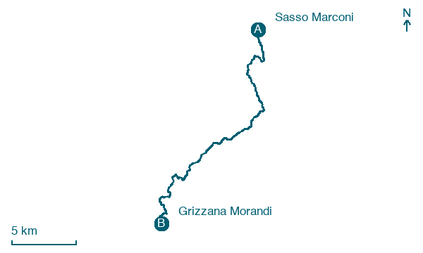
Sasso Marconi → Grizzana Morandi
Walking distance 22 km
Download Appy for the stage map
Stage information
- Ascent
- 617 m
- Descent
- 199 m
Difficulty: moderate
Walking the stage
Tackle a demanding 22 km stage from Sasso Marconi to Grizzana Morandi, with 617 m of climbing on the way.
Before leaving Sasso Marconi, locate Chiesa di S. Pietro on the map. It is close to the starting point.
Look for these places on the stage map: Sirano, Creda di Sotto, Ca' dei Schiavi, and Cà Benassi.
What to see on this stage
History and landmarks
Centro Civico
Palace · 200 m from the trail as the crow flies
Chiesa di S. Pietro
Church · 200 m from the trail as the crow flies
Nature and landscape
La Rocca
Summit · 1.8 km from the trail as the crow flies
A small hill of 476 metres whose vertical sandstone walls are Bologna's classic climbing crag: more than 180 routes from 3b to 8a+ and a CAI via ferrata. Climbers dug and fitted the rock themselves.
Monte Abelle
Summit · 200 m from the trail as the crow flies
Map · Sasso Marconi → Grizzana Morandi
Take your walk with you: download Appy
Via della Lana e della Seta: Sasso Marconi → Grizzana Morandi. Explore maps, stages and elevation in the app, and plan your train or bus journey.

