Grizzana Morandi → Castiglione dei Pepoli
Walking distance 22 km
Download Appy for the stage map
Stage information
- Ascent
- 486 m
- Descent
- 464 m
Difficulty: moderate
Walking the stage
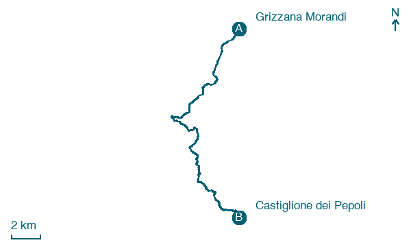
Walk 22 km from Grizzana Morandi to Castiglione dei Pepoli, with 486 m of climbing along the way.
Look for these places on the stage map: Stanco di Sopra, Collina, Burzanella, and San Damiano.
What to see on this stage
History and landmarks
Torre dell'Orologio
Tower · 500 m from the trail as the crow flies
Castellaccio
Castle · 600 m from the trail as the crow flies
Nature and landscape
Lago di Santa Maria
Lake · 100 m from the trail as the crow flies
Monte Vigese
Summit · 400 m from the trail as the crow flies
Map · Grizzana Morandi → Castiglione dei Pepoli
Take your walk with you: download Appy
Via della Lana e della Seta: Grizzana Morandi → Castiglione dei Pepoli. Explore maps, stages and elevation in the app, and plan your train or bus journey.

