Nuxis → Santadi
Walking distance 20.6 km
Download Appy for the stage map
Stage information
- Ascent
- 646 m
- Descent
- 711 m
Difficulty: moderate
Walking the stage
A short walk of about 15 km from Nuxis to Santadi, mostly on secondary roads, past the barite quarry of Rio Bacchera and the Roman onyx quarry of Tattinu. It passes the closed Sacred Well of Tattinu and the Byzantine church of Sant'Elia, seen only from outside, before reaching the museum in Santadi.
Before leaving Nuxis, locate Municipal Cemetery on the map. It is close to the starting point. On arrival in Santadi, consider a stop at Casa, close to the finish.
Look for these places on the stage map: S'Acqua Callenti de Basciu, Is Pirosus, Morimenta de Basciu, and Case del Frate.
What to see on this stage
History and landmarks
Municipal Cemetery
< 100 m from the trail as the crow flies
The cemetery's wall, plastered, has a square plan. The portal, which connects two service rooms on the sides, is arched, topped by a small pediment with a triangular tympanum.
Casa
< 100 m from the trail as the crow flies
The building retains the appearance of the traditional Sulcitana farmhouse, divided into areas that are still clearly distinguishable today (the anteroom, the dining room, and opposite are the bedroom and the kitchen overlooking the internal courtyard).
Nature and landscape
Olivo di Is Pirosus, Santadi
Monumental tree · 1 km from the trail as the crow flies
Italy’s monumental tree register identifies this specimen as Olea europaea L. It records a height of 6.4 m and a trunk circumference of 680 cm.
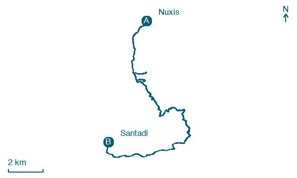
Map · Nuxis → Santadi
Take your walk with you: download Appy
Cammino Minerario di Santa Barbara: Nuxis → Santadi. Explore maps, stages and elevation in the app, and plan your train or bus journey.

