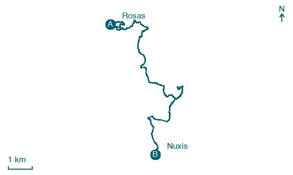
Rosas → Nuxis
Walking distance 13.1 km
Download Appy for the stage map
Stage information
- Ascent
- 293 m
- Descent
- 349 m
Difficulty: easy
Walking the stage
This walk of about 13 km descends from Rosas to the plains of Lower Sulcis, passing the lead, zinc and copper mine of Sa Marchesa and its museum. It follows the old railway line toward Sant'Antioco, passing beneath one of its bridges and several disused limestone quarries, before reaching Nuxis.
Before leaving Rosas, locate Mining Administration Office Building on the map. It is close to the starting point.
Look for these places on the stage map: Is Aios and Acquacadda.
What to see on this stage
History and landmarks
Mining Administration Office Building
Palace · < 100 m from the trail as the crow flies
The building is situated on the hill with two floors. A circular projection is added at a lower half-floor.
Industrial Building
< 100 m from the trail as the crow flies
The main building has four stepped floors resting on the mountain slope with a portico; the central body has infill made of corrugated sheet metal and large windows with small grid patterns; with small attached structures made of stone masonry or metal framework and sheets.
Nature and landscape
Lago di Bau Pressiu
Lake · 1.7 km from the trail as the crow flies
Map · Rosas → Nuxis
Take your walk with you: download Appy
Cammino Minerario di Santa Barbara: Rosas → Nuxis. Explore maps, stages and elevation in the app, and plan your train or bus journey.

