San Pedro de Trones → A Rúa
Walking distance 29.9 km
Download Appy for the stage map
Stage information
- Ascent
- 381 m
- Descent
- 495 m
Difficulty: moderate
Walking the stage
Walk 30 km from San Pedro de Trones to A Rúa, passing Quereño and Sobradelo, with 381 m of ascent.
Before leaving San Pedro de Trones, locate Castro de Vilabarbás on the map. It is close to the starting point.
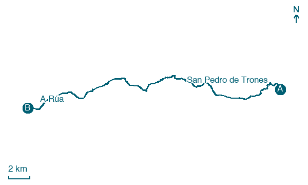
Look for these places on the stage map: Quereño, Sobradelo, A Rampla, and San Miguel do Outeiro.
What to see on this stage
History and landmarks
Salas de la Ribera
1.9 km from the trail as the crow flies
Castro de Vilabarbás
Archaeological site · 200 m from the trail as the crow flies
Nature and landscape
Embalse de Santiago
Lake · < 100 m from the trail as the crow flies
Lake, in Vilamartín de Valdeorras, Spain, at 300 m elevation.
Pumares Reservoir
Lake · 300 m from the trail as the crow flies
Map · San Pedro de Trones → A Rúa
Take your walk with you: download Appy
Camino de Invierno: San Pedro de Trones → A Rúa. Explore maps, stages and elevation in the app, and plan your train or bus journey.

