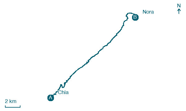
Chia → Nora
Walking distance 20.4 km
Download Appy for the stage map
Stage information
- Ascent
- 100 m
- Descent
- 120 m
Difficulty: moderate
Walking the stage
Coast road and beach lead to Nora, where the small church of Sant'Efisio stands close to the sea at the place of the saint's martyrdom, the Torre del Coltellazzo standing on its islet just offshore. The Roman and Phoenician ruins of Nora lie on the peninsula beyond.
Before leaving Chia, locate Torre di Chia on the map. It is close to the starting point.
Look for these places on the stage map: Eden Rock, Santa Margherita di Pula, Foxi 'e Sali, and Pula.
What to see on this stage
History and landmarks
Torre di Chia
Tower · < 100 m from the trail as the crow flies
Tower, in Domus de Maria, Italy, designated as Italian national heritage.
Villa Serra
Palace · 1.8 km from the trail as the crow flies
A large garden with exotic plants surrounds the building, which is structured over two floors. The main floor is directly connected to the garden by a double-flight staircase.
Map · Chia → Nora
Take your walk with you: download Appy
Cammino 100 Torri: Via del Martirio: Chia → Nora. Explore maps, stages and elevation in the app, and plan your train or bus journey.

