Prat de Bouc → Murat
Walking distance 16.8 km
Download Appy for the stage map
Stage information
- Ascent
- 234 m
- Descent
- 654 m
Difficulty: easy
Walking the stage
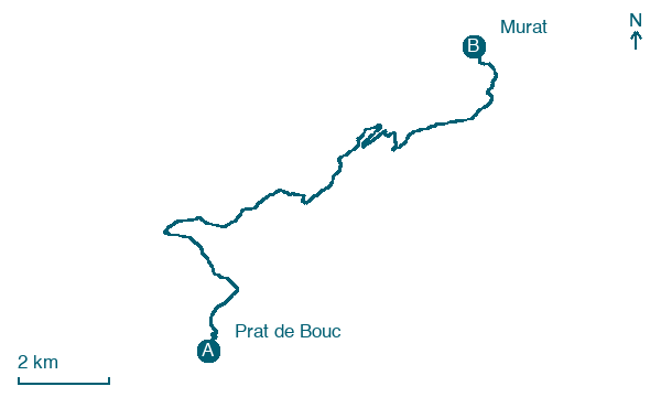
Descend 17 km from Prat de Bouc back to Murat via La Molède, Empallat and Le Martinet, with just 234 m of climbing.
On arrival in Murat, consider a stop at Rocher de Bonnevie, close to the finish.
Look for these places on the stage map: La Molède, Empallat, and Le Martinet.
What to see on this stage
History and landmarks
Château de Beccoire
Castle · < 100 m from the trail as the crow flies
Only vestiges remain of a royal castle built on the order of Saint Louis in the 13th century. It served as the roaming seat of the bailiwick of the Montagnes d'Auvergne.
Rocher de Bonnevie
300 m from the trail as the crow flies
Volcanic neck rising over Murat, a town built at its foot. A statue of the Madonna and Child crowns the summit, at about 1,061 m, and overlooks the town.
Map · Prat de Bouc → Murat
Take your walk with you: download Appy
GR400 - Tour du Cantal: Prat de Bouc → Murat. Explore maps, stages and elevation in the app, and plan your train or bus journey.

