Sansepolcro → Citerna
Walking distance 12.2 km
Download Appy for the stage map
Stage information
- Ascent
- 206 m
- Descent
- 62 m
Difficulty: easy
Walking the stage
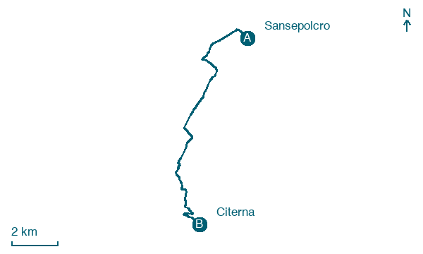
Walk 12 km from Sansepolcro to Citerna with 206 m of climbing, passing Gricignano and Santa Fiora.
Before leaving Sansepolcro, locate Casa Buitoni on the map. It is close to the starting point.
Look for these places on the stage map: Gricignano, Giardino, Ca' de' Conte, and Bertine.
What to see on this stage
History and landmarks
Casa Buitoni
Palace · 900 m from the trail as the crow flies
Building with an irregular plan; perimeter walls in mixed masonry and load-bearing steel structure; roof covering with a pavilion roof.
Villa Massi
Palace · 900 m from the trail as the crow flies
building in L shape with perimeter walls made of mixed masonry; roof with nine staggered slopes
Map · Sansepolcro → Citerna
Take your walk with you: download Appy
Via di Francesco di Roma: Sansepolcro → Citerna. Explore maps, stages and elevation in the app, and plan your train or bus journey.

