Polla → Pertosa
Walking distance 7.8 km
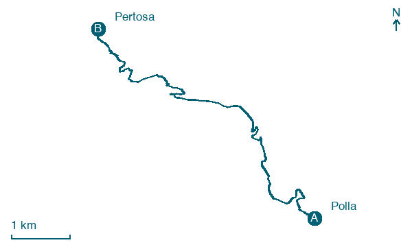
Download Appy for the stage map
Stage information
- Ascent
- 312 m
- Descent
- 488 m
Difficulty: easy
Walking the stage
Cover 8 km from Polla to Pertosa, climbing 312 m, a short stage that ends in Pertosa, so pace yourself.
Before leaving Polla, locate Apolla on the map. It is close to the starting point.
Look for these places on the stage map: Muraglione.
What to see on this stage
History and landmarks
Santuario di Sant'Antonio
500 m from the trail as the crow flies
A Franciscan convent church with a Renaissance look, frescoes inside and a sixteenth century portal. In June 2010 a wooden bust of Saint Anthony here seemed to shed tears, and in 2011 the church became a diocesan sanctuary.
Apolla
200 m from the trail as the crow flies
The village has a medieval structure with a castle dating back to the 12th century. Among the historical-architectural testimonies is the Franciscan convent of Sant’Antonio from the centuries.
Nature and landscape
Cipresso comune di Convento di Sant'Antonio - Via Michele Ragolia, Polla
Monumental tree · 500 m from the trail as the crow flies
Italy’s monumental tree register identifies this specimen as Cupressus sempervirens L. It records a height of 25 m and a trunk circumference of 344 cm.
Map · Polla → Pertosa
Take your walk with you: download Appy
Cammino del Negro: Polla → Pertosa. Explore maps, stages and elevation in the app, and plan your train or bus journey.

