Roccafluvione → Acquasanta Terme
Walking distance 10.9 km
Download Appy for the stage map
Stage information
- Ascent
- 571 m
- Descent
- 494 m
Difficulty: moderate
Walking the stage
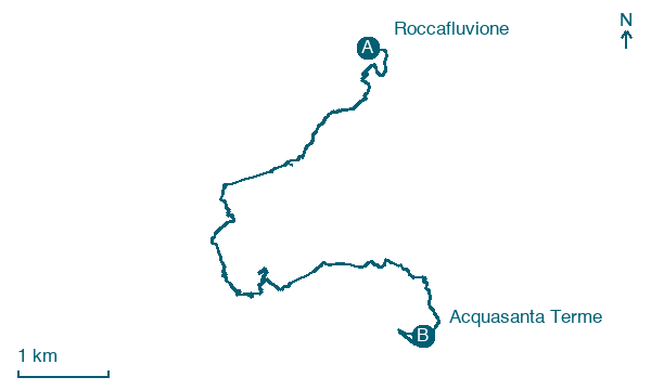
Stage 5 (Roccafluvione → Acquasanta Terme) covers 10.9 km on foot.
On arrival in Acquasanta Terme, consider a stop at Castel di Luco, close to the finish.
Look for these places on the stage map: Venamartello, Cocoscia, Luco, and Valledacqua.
What to see on this stage
History and landmarks
Castel di Luco
Castle · < 100 m from the trail as the crow flies
Castle, in Acquasanta Terme, Italy, designated as Italian national heritage.
Casa dei Combattenti
700 m from the trail as the crow flies
Building consisting of a main volume and an attached volume, located at the far right, set back from the first.
Nature and landscape
Roverella di Centrale, Acquasanta Terme
Monumental tree · 500 m from the trail as the crow flies
Italy’s monumental tree register identifies this specimen as Quercus pubescens Willd. It records a height of 18 m and a trunk circumference of 410 cm.
Map · Roccafluvione → Acquasanta Terme
Take your walk with you: download Appy
Grande Anello dei Borghi Ascolani: Roccafluvione → Acquasanta Terme. Explore maps, stages and elevation in the app, and plan your train or bus journey.

