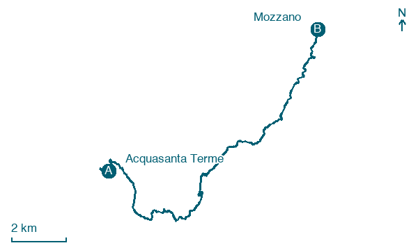
Acquasanta Terme → Mozzano
Walking distance 17.8 km
Download Appy for the stage map
Stage information
- Ascent
- 616 m
- Descent
- 591 m
Difficulty: moderate
Walking the stage
Stage 6 (Acquasanta Terme → Mozzano) covers 17.8 km on foot.
Before leaving Acquasanta Terme, locate Castel di Luco on the map. It is close to the starting point.
Look for these places on the stage map: Valledacqua, San Gregorio, Talvacchia, and Coperso.
What to see on this stage
History and landmarks
Castel di Luco
Castle · 700 m from the trail as the crow flies
Castle, in Acquasanta Terme, Italy, designated as Italian national heritage.
Consolidation Infrastructure, Substructure
Archaeological site · 1.5 km from the trail as the crow flies
At the height of Taverna Piccinini, but on the opposite bank, there are three sections of what was once a single containment wall of the Salaria.
Nature and landscape
Lago di Talvacchia
Lake · 600 m from the trail as the crow flies
Lake, in Province of Ascoli Piceno, Italy, at 507 m elevation, 35.0 km long.
Roverella di Centrale, Acquasanta Terme
Monumental tree · 1.8 km from the trail as the crow flies
Italy’s monumental tree register identifies this specimen as Quercus pubescens Willd. It records a height of 18 m and a trunk circumference of 410 cm.
Map · Acquasanta Terme → Mozzano
Take your walk with you: download Appy
Grande Anello dei Borghi Ascolani: Acquasanta Terme → Mozzano. Explore maps, stages and elevation in the app, and plan your train or bus journey.

