Santa Severa → Cerveteri (Piano del Candeliere)
Walking distance 11.5 km
Download Appy for the stage map
Stage information
- Ascent
- 4 m
- Descent
- 2 m
Difficulty: easy
Walking the stage
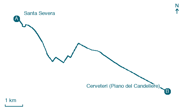
Walk 12 km from Santa Severa to Cerveteri (Piano del Candeliere) via Santa Severa Nord and Due Casette, an easy day with just 4 m of ascent.
Before leaving Santa Severa, locate Santa Severa Castle on the map. It is close to the starting point.
Look for these places on the stage map: Santa Severa Nord, Due Casette, and Fosso dell'Isolotto.
What to see on this stage
History and landmarks
Santa Severa Castle
Castle · < 100 m from the trail as the crow flies
Museum of Santa Severa Castle
Museum · < 100 m from the trail as the crow flies
Map · Santa Severa → Cerveteri (Piano del Candeliere)
Take your walk with you: download Appy
Cammino di Hasekura e dei martiri giapponesi: Santa Severa → Cerveteri (Piano del Candeliere). Explore maps, stages and elevation in the app, and plan your train or bus journey.

