Civitavecchia → Santa Severa
Walking distance 21.9 km
Download Appy for the stage map
Stage information
- Ascent
- 67 m
- Descent
- 66 m
Difficulty: easy
Walking the stage
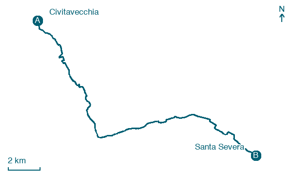
Stroll 22 km on gentle, almost flat ground from Civitavecchia to Santa Severa, passing Prato del Mare and Perazzeta.
Before leaving Civitavecchia, locate Forte Michelangelo on the map. It is close to the starting point.
Look for these places on the stage map: Prato del Mare, Perazzeta, Elcetina, and Cooperativa Casa Mia.
What to see on this stage
History and landmarks
Forte Michelangelo
< 100 m from the trail as the crow flies
Villa La Saracena
< 100 m from the trail as the crow flies
Nature and landscape
Spiaggia di Civitavecchia
Beach · < 100 m from the trail as the crow flies
Map · Civitavecchia → Santa Severa
Take your walk with you: download Appy
Cammino di Hasekura e dei martiri giapponesi: Civitavecchia → Santa Severa. Explore maps, stages and elevation in the app, and plan your train or bus journey.

