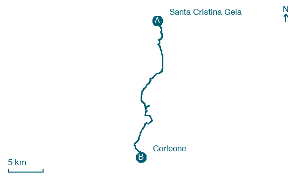
Santa Cristina Gela → Corleone
Walking distance 26.4 km
Download Appy for the stage map
Stage information
- Ascent
- 648 m
- Descent
- 761 m
Difficulty: moderate
Walking the stage
Walk 26 km from Santa Cristina Gela to Corleone with 648 m of climbing, passing Sant'Agata and Borgo Aquila.
On arrival in Corleone, consider a stop at Museo civico di Corleone, close to the finish.
Look for these places on the stage map: Sant'Agata, Borgo Aquila, and Borgo Saladino.
What to see on this stage
History and landmarks
Museo civico di Corleone
Museum · < 100 m from the trail as the crow flies
Civic Museum of Corleone. Museum, in Corleone, Italy, designated as Italian national heritage.
Corleone Castle
Castle · 300 m from the trail as the crow flies
Ruined castle on a rocky spur above the town: the walls have collapsed, but a round tower topped by a dry-stone dome still stands. A landslide in 1418 destroyed the San Giuliano quarter below and part of the castle.
Nature and landscape
Gole del torrente Corleone
800 m from the trail as the crow flies
Map · Santa Cristina Gela → Corleone
Take your walk with you: download Appy
Magna Via Francigena: Santa Cristina Gela → Corleone. Explore maps, stages and elevation in the app, and plan your train or bus journey.

