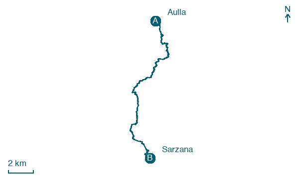
Aulla → Sarzana
Walking distance 17.4 km
Download Appy for the stage map
Stage information
- Ascent
- 621 m
- Descent
- 661 m
Difficulty: moderate
Walking the stage
Climb 621 m over 17 km from Aulla to Sarzana, a demanding stage with a steady ascent, passing through Bibola and Vecchietto.
Before leaving Aulla, locate Abbey of San Caprasio in Aulla on the map. It is close to the starting point. On arrival in Sarzana, consider a stop at Palazzo Roderio, close to the finish.
Look for these places on the stage map: Bibola, Vecchietto, Ponzano Superiore, and Piano di Vezzano 2.
What to see on this stage
History and landmarks
Abbey of San Caprasio in Aulla
Archaeological site · < 100 m from the trail as the crow flies
Benedictine abbey, originally dedicated to the Virgin Mary and later re-dedicated to Saint Caprasius in 1077. Here you can see the remains of an ancient monastery that served as a hostel along the route to Rome.
Palazzo Roderio
Palace · < 100 m from the trail as the crow flies
15th-century palace, in Sarzana, Italy, designated as Italian national heritage.
Nature and landscape
Falsa canfora di Vecchio Ospedale - Via Agostino Paci, Sarzana
Monumental tree · 200 m from the trail as the crow flies
Italy’s monumental tree register identifies this specimen as Cinnamomum glanduliferum (Wall.) Meisn. It records a height of 20 m and a trunk circumference of 361 cm.
Map · Aulla → Sarzana
Take your walk with you: download Appy
Via Francigena: Aulla → Sarzana. Explore maps, stages and elevation in the app, and plan your train or bus journey.

