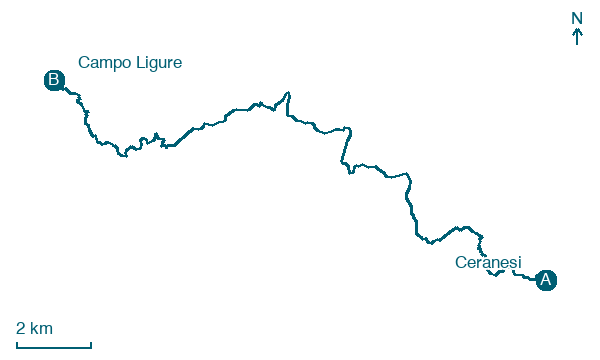
Ceranesi → Campo Ligure
Walking distance 23.5 km
Download Appy for the stage map
Stage information
- Ascent
- 551 m
- Descent
- 978 m
Difficulty: moderate
Walking the stage
Follow a 24 km stage from Ceranesi to Campo Ligure, with 551 m of climbing on the way, passing through Camposilvano and Torbi.
On arrival in Campo Ligure, consider a stop at Palazzo Spinola, close to the finish.
Look for these places on the stage map: Camposilvano, Torbi, Capanne di Marcarolo, and Maddalena.
What to see on this stage
History and landmarks
Castello di Campo Ligure
Castle · < 100 m from the trail as the crow flies
Castle, in Campo Ligure, Italy, designated as Italian national heritage.
Palazzo Spinola
Palace · < 100 m from the trail as the crow flies
Palace, in Campo Ligure, Italy.
Nature and landscape
Monte Orditano
Summit · 300 m from the trail as the crow flies
Peak at 950 m elevation. Monte Orditano is a mountain in Liguria, northern Italy, part of the Ligurian Apennines.
Giardino Botanico Montano di Pratorondanino
National park · 200 m from the trail as the crow flies
Map · Ceranesi → Campo Ligure
Take your walk with you: download Appy
Cammino dei Santuari del Mare: Ceranesi → Campo Ligure. Explore maps, stages and elevation in the app, and plan your train or bus journey.

