Genova → Ceranesi
Walking distance 12.9 km
Download Appy for the stage map
Stage information
- Ascent
- 937 m
- Descent
- 160 m
Difficulty: moderate
Walking the stage
Climb 937 m over 13 km from Genova to Ceranesi, a demanding stage with a steady ascent, passing through Panigaro and Serra.
Before leaving Genova, locate Santissima Annunziata della Costa on the map. It is close to the starting point.
Look for these places on the stage map: Panigaro, Gneo, Camposilvano, and Livellato.
What to see on this stage
History and landmarks
Santissima Annunziata della Costa
< 100 m from the trail as the crow flies
Church founded in 1351 by three Spanish monks of the Hermits of Saint Jerome, first called Our Lady of Consolation. Inside, three aisles on octagonal pillars carry ribbed vaults with carved stone medallions, over a chequered floor of slate and white marble.
Gazzo Mountain
< 100 m from the trail as the crow flies
A limestone summit of 419 metres with a sanctuary to Our Lady of Mercy on top, its flanks eaten away by centuries of quarrying. In the plague of 1656-57 the people of Sestri sheltered in its caves; a speleology museum opened near the top in 1969.
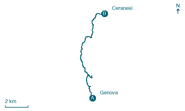
Map · Genova → Ceranesi
Take your walk with you: download Appy
Cammino dei Santuari del Mare: Genova → Ceranesi. Explore maps, stages and elevation in the app, and plan your train or bus journey.

