Siena → Buonconvento
Walking distance 30.3 km
Download Appy for the stage map
Stage information
- Ascent
- 542 m
- Descent
- 718 m
Difficulty: moderate
Walking the stage
Cover 30 km from Siena to Buonconvento, climbing 542 m, passing Isola d'Arbia and Monteroni d'Arbia.
Before leaving Siena, locate Palazzo de' Vecchi on the map. It is close to the starting point.
Look for these places on the stage map: Isola d'Arbia, Ponte a Tressa, Monteroni d'Arbia, and Lucignano d'Arbia.
What to see on this stage
History and landmarks
Palazzo Biringucci Landi Bruchi
Palace · < 100 m from the trail as the crow flies
Palace, in Siena, Italy, designated as Italian national heritage.
Palazzo de' Vecchi
Palace · < 100 m from the trail as the crow flies
Palace, in Siena, Italy, designated as Italian national heritage.
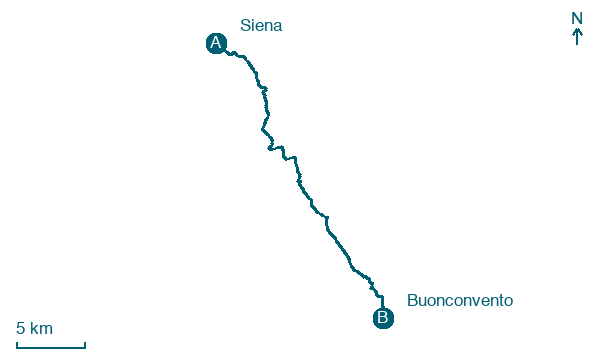
Map · Siena → Buonconvento
Take your walk with you: download Appy
Romea Strata Italiana: Siena → Buonconvento. Explore maps, stages and elevation in the app, and plan your train or bus journey.

