Rieti → Rocca Sinibalda
Walking distance 20.3 km
Download Appy for the stage map
Stage information
- Ascent
- Estimated 812 m
- Descent
- Estimated 710 m
Difficulty: easy
Walking the stage
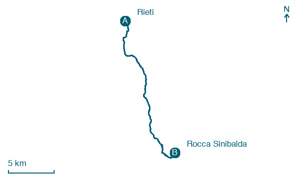
Walk 20 km from Rieti to Rocca Sinibalda, passing Case San Benedetto and Seconde Ville di Belmonte.
Before leaving Rieti, locate Palazzo Vecchiarelli on the map. It is close to the starting point.
Look for these places on the stage map: Case San Benedetto, Terze Ville di Belmonte, Belmonte in Sabina, and Pantana.
What to see on this stage
History and landmarks
Ponte romano di Rieti
Bridge · < 100 m from the trail as the crow flies
The Roman Bridge is a bridge from the Roman era that spanned the Velino River in Rieti.
Palazzo Vecchiarelli
Palace · < 100 m from the trail as the crow flies
Palazzo Vecchiarelli is a palace in Rieti. It is located halfway along via Roma, next to the former church of San Pietro.
Map · Rieti → Rocca Sinibalda
Take your walk with you: download Appy
Cammino di San Benedetto: Rieti → Rocca Sinibalda. Explore maps, stages and elevation in the app, and plan your train or bus journey.

