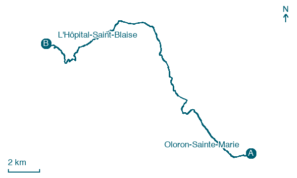
Oloron-Sainte-Marie → L'Hôpital-Saint-Blaise
Walking distance 22.9 km
Download Appy for the stage map
Stage information
- Ascent
- 424 m
- Descent
- 481 m
Difficulty: moderate
Walking the stage
Leave the Pyrenean foothills behind and enter the rolling hills of the Pays Basque, crossing into the Soule territory to reach the tranquil village of L'Hôpital-Saint-Blaise.
Before leaving Oloron-Sainte-Marie, locate Vestiges romains on the map. It is close to the starting point.
Look for these places on the stage map: Pondeilh, Orin, Aren, and Préchacq-Josbaig.
What to see on this stage
History and landmarks
Oloron Cathedral
Cathedral · < 100 m from the trail as the crow flies
Vestiges romains
Archaeological site · < 100 m from the trail as the crow flies
Nature and landscape
Plage de Poey d'Oloron
Beach · 100 m from the trail as the crow flies
Plage d'Orin
Beach · 700 m from the trail as the crow flies
Map · Oloron-Sainte-Marie → L'Hôpital-Saint-Blaise
Take your walk with you: download Appy
Camino de Lourdes: Oloron-Sainte-Marie → L'Hôpital-Saint-Blaise. Explore maps, stages and elevation in the app, and plan your train or bus journey.

