Wilgartswiesen → Reichenbach
Walking distance 15.7 km
Download Appy for the stage map
Stage information
- Ascent
- 522 m
- Descent
- 572 m
Difficulty: moderate
Walking the stage
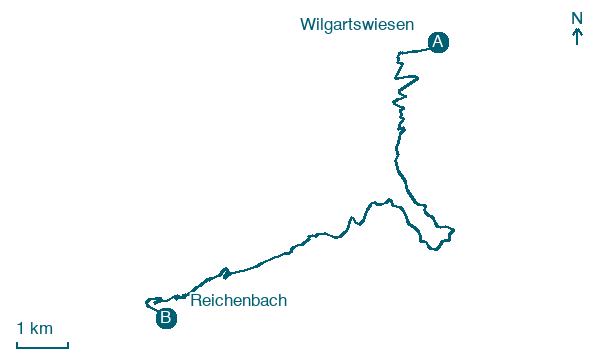
Follow 16 km from Wilgartswiesen to Reichenbach through Schwanheim and Erfweiler, climbing 522 m.
Look for these places on the stage map: Schwanheim and Erfweiler.
What to see on this stage
History and landmarks
Winterberg
300 m from the trail as the crow flies
The Winterberg is a mountain with an elevation of 460.8 m above NHN in the northeastern Wasgau, which is also known as the southern part of the Pfälzerwald.
Hoher Kopf
500 m from the trail as the crow flies
A 442-metre wooded summit whose south side breaks out into a sandstone tower, the Stephansturm, nicknamed the Camel for its shape of two towers. It is a popular climbing rock with 21 routes, and the Pfälzer Waldpfad passes along its west flank.
Nature and landscape
Hochberg (Dahn)
Summit · 600 m from the trail as the crow flies
Peak, in Rhineland-Palatinate, Germany, at 420 m elevation.
Hochstein
Summit · 1.1 km from the trail as the crow flies
Peak, in Rhineland-Palatinate, Germany, at 345 m elevation.
Map · Wilgartswiesen → Reichenbach
Take your walk with you: download Appy
Pfälzer Waldpfad: Wilgartswiesen → Reichenbach. Explore maps, stages and elevation in the app, and plan your train or bus journey.

