Merzalben → Wilgartswiesen
Walking distance 22.8 km
Download Appy for the stage map
Stage information
- Ascent
- 492 m
- Descent
- 526 m
Difficulty: moderate
Walking the stage
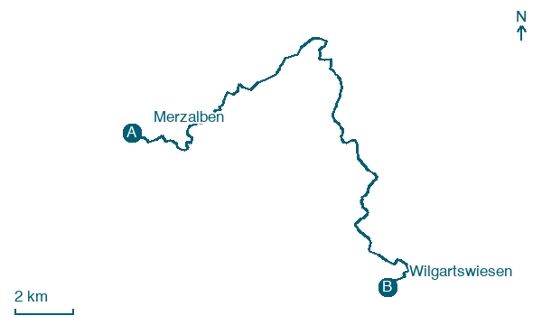
Stride 23 km from Merzalben to Wilgartswiesen via Leimen and Hermersbergerhof, with 492 m of ascent.
On arrival in Wilgartswiesen, consider a stop at Neding, close to the finish.
Look for these places on the stage map: Leimen and Hermersbergerhof.
What to see on this stage
History and landmarks
Neding
Summit · 200 m from the trail as the crow flies
The Neding near Hauenstein in the district of Südwestpfalz in Rhineland-Palatinate is a mountain with an elevation of 336.3 m above NHN in the northern Wasgau in the Pfälzerwald. On the ridge, there are numerous rock formations of sandstone, such as the Nedingfelsen with a rock gate.
Wieslauterhof
1.5 km from the trail as the crow flies
Heritage site, in Merzalben, Germany, designated as cultural heritage monument in Germany.
Nature and landscape
Schloßberg
Summit · < 100 m from the trail as the crow flies
Peak, in Rhineland-Palatinate, Germany, at 468 m elevation.
Katzenkopf
Summit · 200 m from the trail as the crow flies
Map · Merzalben → Wilgartswiesen
Take your walk with you: download Appy
Pfälzer Waldpfad: Merzalben → Wilgartswiesen. Explore maps, stages and elevation in the app, and plan your train or bus journey.

