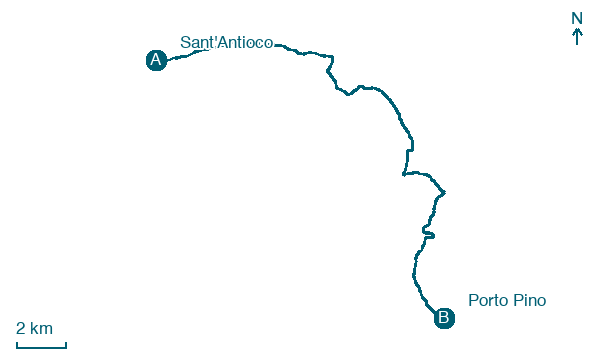
Sant'Antioco → Porto Pino
Walking distance 23.6 km
Download Appy for the stage map
Stage information
- Ascent
- 59 m
- Descent
- 42 m
Difficulty: moderate
Walking the stage
Sand track follows the curve of the Golfo di Palmas coast south, past small rocky coves, to the Spiaggia dei Francesi, a beach on the wide Porto Pino dune system. The stage ends among the dunes at Porto Pino, with the open sea visible beyond the dune crests.
Before leaving Sant'Antioco, locate Archaeological Complex of Sant'Antioco on the map. It is close to the starting point.
Look for these places on the stage map: Is Loddus, Porto Botte, Is Potettus, and Portopinetto.
What to see on this stage
History and landmarks
Archaeological Complex of Sant'Antioco
Archaeological site · 700 m from the trail as the crow flies
Archaeological site, in Sant'Antioco, Italy, designated as Italian national heritage.
Sulci
1.4 km from the trail as the crow flies
Historic center. Sulci or Sulki (in Greek Σολκοί, Steph.)
Map · Sant'Antioco → Porto Pino
Take your walk with you: download Appy
Cammino 100 Torri: Via del Martirio: Sant'Antioco → Porto Pino. Explore maps, stages and elevation in the app, and plan your train or bus journey.

