Chantada → Rodeiro
Walking distance 25.2 km
Download Appy for the stage map
Stage information
- Ascent
- 701 m
- Descent
- 558 m
Difficulty: moderate
Walking the stage
Cross 25 km from Chantada to Rodeiro, passing San Xurxo and Garabelos, with 701 m of ascent.
Before leaving Chantada, locate Church of Santa Mariña de Chantada on the map. It is close to the starting point.
Look for these places on the stage map: San Xurxo, Penasillás, Freán, and A Feira.
What to see on this stage
History and landmarks
Monastery of San Salvador de Asma
Monastery · 1 km from the trail as the crow flies
Romanesque church of a former double monastery of monks and nuns, with a single medieval nave and a side portal from the late twelfth century. The apse columns carry carved plant, animal and human figures.
Church of Santa Mariña de Chantada
Church · 100 m from the trail as the crow flies
Church in Neoclassical style, in Chantada, Spain.
Nature and landscape
Monte Faro
Summit · 600 m from the trail as the crow flies
21st-century peak, in Carballedo, Spain, at 1,181 m elevation, covering 2999.4 km².
Sierra del Faro
Summit · 600 m from the trail as the crow flies
Peak, in O Deza, Spain, at 1,187 m elevation.
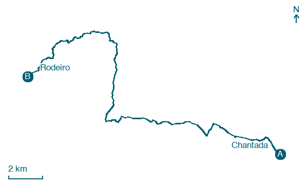
Map · Chantada → Rodeiro
Take your walk with you: download Appy
Camino de Invierno: Chantada → Rodeiro. Explore maps, stages and elevation in the app, and plan your train or bus journey.

