Vercelli → Robbio
Walking distance 18.6 km
Download Appy for the stage map
Stage information
- Ascent
- 11 m
- Descent
- 13 m
Difficulty: easy
Walking the stage
Walk an easy 19 km from Vercelli to Robbio, with only 11 m of climbing along the way, passing through Brarola and Palestro.
Before leaving Vercelli, locate Palazzo Tizzoni on the map. It is close to the starting point.
Look for these places on the stage map: Bivio Sesia, Torrione Rossignoli, Palestro, and Rivoltella.
What to see on this stage
History and landmarks
Palazzo Tizzoni
Palace · < 100 m from the trail as the crow flies
15th-century palace, dedicated to Tizzoni, in Vercelli, Italy, designated as Italian national heritage.
Museo Archeologico Città di Vercelli "Luigi Bruzza" (MAC)
Museum · < 100 m from the trail as the crow flies
Archaeological Museum of the City of Vercelli "Luigi Bruzza" (MAC). 21st-century museum, dedicated to Luigi Maria Bruzza, in Vercelli, Italy.
Nature and landscape
Glicine di Universita' di Vercelli - Via Galileo Ferraris, Vercelli
Monumental tree · 400 m from the trail as the crow flies
Italy’s monumental tree register identifies this specimen as Wisteria sinensis (Sims) Sweet. It records a height of 13 m and a trunk circumference of 350 cm.
Noce satinato di Piazza Sant'Eusebio, Vercelli
Monumental tree · 600 m from the trail as the crow flies
Italy’s monumental tree register identifies this specimen as Liquidambar styracyflua L. It records a height of 32 m and a trunk circumference of 500 cm.
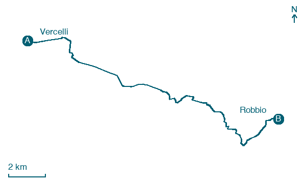
Map · Vercelli → Robbio
Take your walk with you: download Appy
Via Francigena: Vercelli → Robbio. Explore maps, stages and elevation in the app, and plan your train or bus journey.

