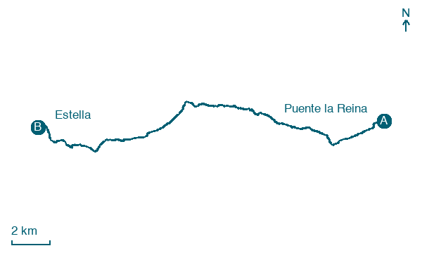
Puente la Reina → Estella
Walking distance 22.6 km
Download Appy for the stage map
Stage information
- Ascent
- 539 m
- Descent
- 458 m
Difficulty: moderate (estimated)
Walking the stage
Follow 23 km from Puente la Reina to Estella through Mañeru, Cirauqui / Zirauki and Villatuerta, climbing 539 m.
Before leaving Puente la Reina, locate Casa de los Cubiertos on the map. It is close to the starting point. On arrival in Estella, consider a stop at Monte redondo, close to the finish.
Look for these places on the stage map: Mañeru, Cirauqui / Zirauki, Arandigoyen / Arandigoien, and Villatuerta.
What to see on this stage
History and landmarks
Muralla de Puente la Reina
< 100 m from the trail as the crow flies
The medieval walls of Puente la Reina once had 21 towers and four gates, with a moat and barbican. Pilgrims entered through the Puerta de Suso.
Casa de los Cubiertos
Palace · < 100 m from the trail as the crow flies
Palace, in Puente La Reina – Gares, Spain, designated as bien de interés cultural.
Nature and landscape
Monte redondo
Summit · 400 m from the trail as the crow flies
Arena Blanca
Summit · 400 m from the trail as the crow flies
Map · Puente la Reina → Estella
Take your walk with you: download Appy
Camino Frances: Puente la Reina → Estella. Explore maps, stages and elevation in the app, and plan your train or bus journey.

