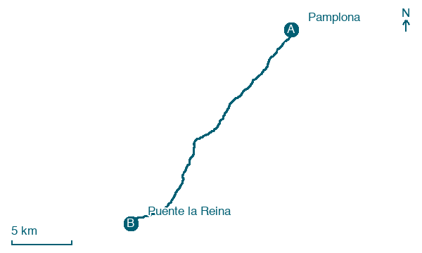
Pamplona → Puente la Reina
Walking distance 22.9 km
Download Appy for the stage map
Stage information
- Ascent
- 486 m
- Descent
- 589 m
Difficulty: moderate (estimated)
Walking the stage
Head out of Pamplona past Cizur Menor and Zariquiegui / Zarikiegi to Puente la Reina, 23 km with 486 m of climbing.
Before leaving Pamplona, locate Sequoya del Palacio de Diputación on the map. It is close to the starting point. On arrival in Puente la Reina, consider a stop at Casa de los Cubiertos, close to the finish.
Look for these places on the stage map: Barañáin / Barañain, Galar, Uterga, and Obanos.
What to see on this stage
History and landmarks
Casa de los Cubiertos
Palace · 200 m from the trail as the crow flies
Palace, in Puente La Reina – Gares, Spain, designated as bien de interés cultural.
Muralla de Puente la Reina
500 m from the trail as the crow flies
The medieval walls of Puente la Reina once had 21 towers and four gates, with a moat and barbican. Pilgrims entered through the Puerta de Suso.
Nature and landscape
Sequoya del Palacio de Diputación
National park · 700 m from the trail as the crow flies
Santixusti
Summit · 100 m from the trail as the crow flies
Map · Pamplona → Puente la Reina
Take your walk with you: download Appy
Camino Frances: Pamplona → Puente la Reina. Explore maps, stages and elevation in the app, and plan your train or bus journey.

