Kedainiai → Paneveziukas
Walking distance 28.5 km
Download Appy for the stage map
Stage information
- Ascent
- 45 m
- Descent
- 39 m
Difficulty: moderate
Walking the stage
Stage 12: Kedainiai → Paneveziukas, about 28 km
Before leaving Kedainiai, locate Evangelical Reformed Church in Kėdainiai on the map. It is close to the starting point. On arrival in Paneveziukas, consider a stop at Panevėžiuko tvenkinys, close to the finish.
Look for these places on the stage map: Novočėbė, Pavikšrupys, Gaižuvėlė, and Lazdynė.
What to see on this stage
History and landmarks
Kėdainiai
100 m from the trail as the crow flies
16th-century historic village, in Kėdainiai City Eldership, Lithuania, at 39 m elevation, covering 19.0 km².
Evangelical Reformed Church in Kėdainiai
Church · < 100 m from the trail as the crow flies
17th-century church in Renaissance style, in Kėdainiai, Lithuania, built in brick.
Nature and landscape
Pelednagiai Botanical Reserve
National park · 500 m from the trail as the crow flies
Panevėžiuko tvenkinys
Lake · 700 m from the trail as the crow flies
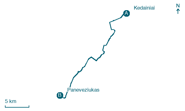
Map · Kedainiai → Paneveziukas
Take your walk with you: download Appy
Cammino Lituano di San Giacomo: Kedainiai → Paneveziukas. Explore maps, stages and elevation in the app, and plan your train or bus journey.

