Paberze → Kedainiai
Walking distance 31.8 km
Download Appy for the stage map
Stage information
- Ascent
- 34 m
- Descent
- 64 m
Difficulty: moderate
Walking the stage
Stage 11: Paberze → Kedainiai, about 32 km
Before leaving Paberze, locate Paberžė Landscape Reserve on the map. It is close to the starting point.
Look for these places on the stage map: Užupė, Surviliškis, Žirnenka, and Daukšiai.
What to see on this stage
History and landmarks
Kėdainiai
1 km from the trail as the crow flies
16th-century historic village, in Kėdainiai City Eldership, Lithuania, at 39 m elevation, covering 19.0 km².
Kėdainiai minaret
Tower · 1.5 km from the trail as the crow flies
19th-century ottoman architecture tower. The Kėdainiai minaret is the only free-standing minaret in Lithuania.
Nature and landscape
Paberžė Landscape Reserve
National park · < 100 m from the trail as the crow flies
Kėdainių tvenkinys
Lake · 1 km from the trail as the crow flies
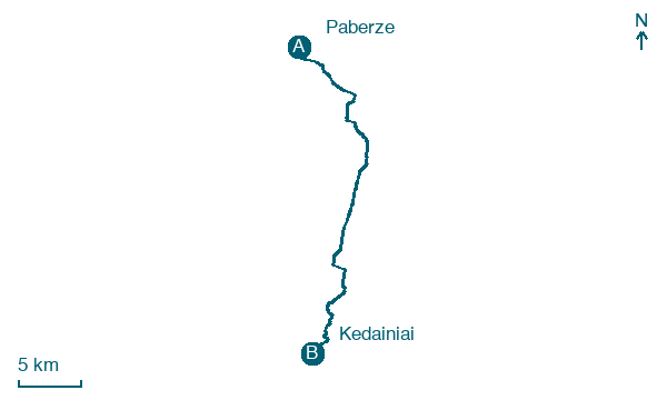
Map · Paberze → Kedainiai
Take your walk with you: download Appy
Cammino Lituano di San Giacomo: Paberze → Kedainiai. Explore maps, stages and elevation in the app, and plan your train or bus journey.

