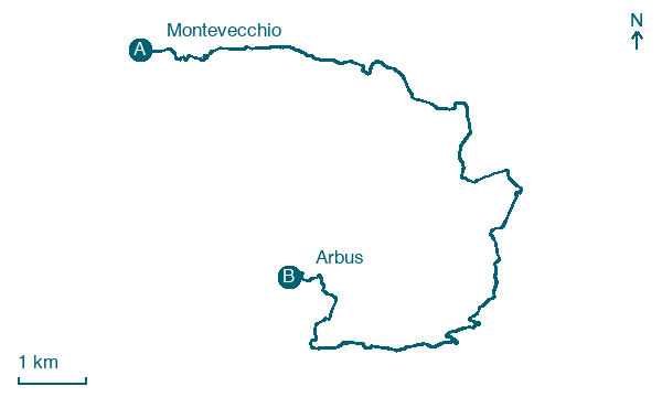
Montevecchio → Arbus
Walking distance 16 km
Download Appy for the stage map
Stage information
- Ascent
- 538 m
- Descent
- 643 m
Difficulty: moderate
Walking the stage
Following the old miners' path, this walk of about 16 km descends from the hills above Montevecchio to the Campidano plain, passing the basalt columns formed by ancient volcanic flows. It then climbs on granite rock into the Linas mountains to reach the town of Arbus.
On arrival in Arbus, consider a stop at Palazzo, close to the finish.
Look for these places on the stage map: Gùspini/Guspini.
What to see on this stage
History and landmarks
Palazzo
Palace · < 100 m from the trail as the crow flies
A rectangular structure built on two above-ground levels. The load-bearing walls are made of local granite with regular and irregular squared blocks, joined with lime mortar.
School
< 100 m from the trail as the crow flies
first school building for the town, built in two phases, realizing a raised structure on the original rectangular layout of 26.20 by 16.70 meters, and adding a staircase block to the southeast with a semicircular corner facade.
Nature and landscape
Olivo di Gedili, Arbus
Monumental tree · 1 km from the trail as the crow flies
Italy’s monumental tree register identifies this specimen as Olea europaea L. It records a height of 7 m and a trunk circumference of 575 cm.
Map · Montevecchio → Arbus
Take your walk with you: download Appy
Cammino Minerario di Santa Barbara: Montevecchio → Arbus. Explore maps, stages and elevation in the app, and plan your train or bus journey.

