Kaiserslautern → Stelzenberg
Walking distance 16.9 km
Download Appy for the stage map
Stage information
- Ascent
- 427 m
- Descent
- 370 m
Difficulty: moderate
Walking the stage
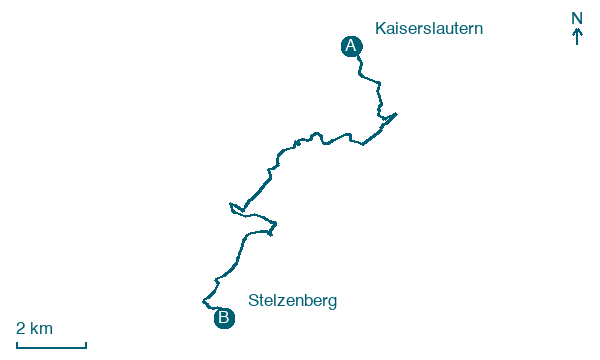
Set out from Kaiserslautern to Stelzenberg, 17 km with 427 m of ascent, passing Alte Schmelz and Walzwerk.
Before leaving Kaiserslautern, locate Villa Kröckel on the map. It is close to the starting point.
Look for these places on the stage map: Alte Schmelz and Walzwerk.
What to see on this stage
History and landmarks
Villa Kröckel
Palace · 500 m from the trail as the crow flies
A neo-Renaissance villa of 1886, built for the contractor Leonhard Kröckel, who owned the sandstone quarry, and decorated with many sandstone sculptures. A nineteenth-century dolphin rider fountain stands in the forecourt.
Villa Munzinger
Palace · 1.1 km from the trail as the crow flies
Palace, in Kaiserslautern, Germany, designated as cultural heritage monument in Germany.
Nature and landscape
Humberg
Summit · < 100 m from the trail as the crow flies
Peak, in Rhineland-Palatinate, Germany, at 425 m elevation.
Betzenberg
Summit · 1.1 km from the trail as the crow flies
Map · Kaiserslautern → Stelzenberg
Take your walk with you: download Appy
Pfälzer Waldpfad: Kaiserslautern → Stelzenberg. Explore maps, stages and elevation in the app, and plan your train or bus journey.

