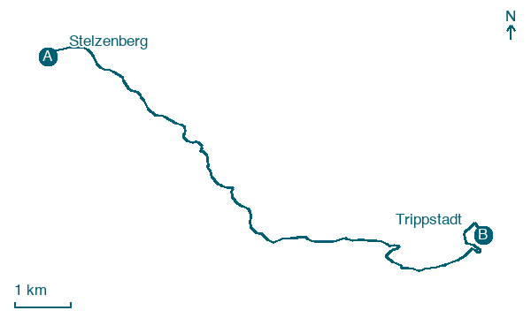
Stelzenberg → Trippstadt
Walking distance 11.7 km
Download Appy for the stage map
Stage information
- Ascent
- 391 m
- Descent
- 247 m
Difficulty: moderate
Walking the stage
Walk the 12 km from Stelzenberg to Trippstadt, a gentler stretch of the trail with 391 m of ascent in total.
What to see on this stage
History and landmarks
Unterhammer (Trippstadt)
< 100 m from the trail as the crow flies
Heritage site, in Trippstadt, Germany, designated as cultural heritage monument in Germany, at 295 m elevation.
Nature and landscape
Karlstalschlucht
National park · < 100 m from the trail as the crow flies
A rocky gorge of red sandstone cut by the Moosalb, about 3 kilometres long, with small waterfalls, old trees and a path over little wooden bridges. The landscape gardener Sckell shaped the trail in the 1780s.
Steinberg
Summit · 1.6 km from the trail as the crow flies
Map · Stelzenberg → Trippstadt
Take your walk with you: download Appy
Pfälzer Waldpfad: Stelzenberg → Trippstadt. Explore maps, stages and elevation in the app, and plan your train or bus journey.

