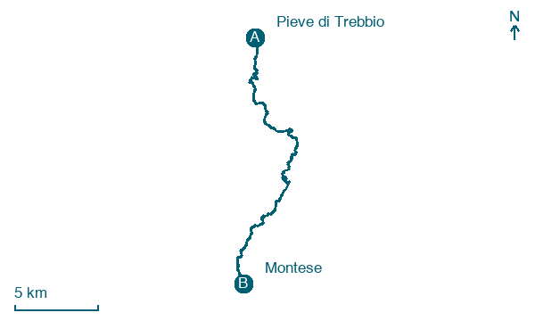
Pieve di Trebbio → Montese
Walking distance 23.9 km
Download Appy for the stage map
Stage information
- Ascent
- 1504 m
- Descent
- 1166 m
Difficulty: challenging
Walking the stage
Walk 24 km from Pieve di Trebbio to Montese with 1504 m of climbing, passing Rocca Malatina and Gainazzo.
Look for these places on the stage map: Rocca Malatina, Gainazzo, Rosola, and Salto.
In Pieve di Trebbio, pause outside the church of San Giovanni Battista. The octagonal baptistery facing it holds a carved ninth-century font. Look for it if the baptistery is open.
Read more at Parchi Emilia Centrale.
Map · Pieve di Trebbio → Montese
Take your walk with you: download Appy
Romea Strata Italiana: Pieve di Trebbio → Montese. Explore maps, stages and elevation in the app, and plan your train or bus journey.

