Orvinio → Mandela
Walking distance 21.9 km
Download Appy for the stage map
Stage information
- Ascent
- 658 m
- Descent
- 1029 m
Difficulty: moderate
Walking the stage
Walk 22 km from Orvinio to Mandela with 658 m of climbing, passing Percile and Licenza, a full day on foot.
Before leaving Orvinio, locate Castello Malvezzi-Campeggi on the map. It is close to the starting point. On arrival in Mandela, consider a stop at Chiesa di San Nicola, close to the finish.
Look for these places on the stage map: Percile, La Posta, Licenza, and Roccagiovine.
What to see on this stage
History and landmarks
Chiesa di San Nicola
Church · < 100 m from the trail as the crow flies
Church of San Nicola. Church, in Mandela, Italy, designated as Italian national heritage.
Castello Malvezzi-Campeggi
Castle · 200 m from the trail as the crow flies
A castle that has watched over the village since around the year 1000, enlarged by the Orsini in the sixteenth century. A cylindrical keep and crenellated walls remain, with a monumental rusticated portal; the upper halls have late sixteenth-century frescoes.
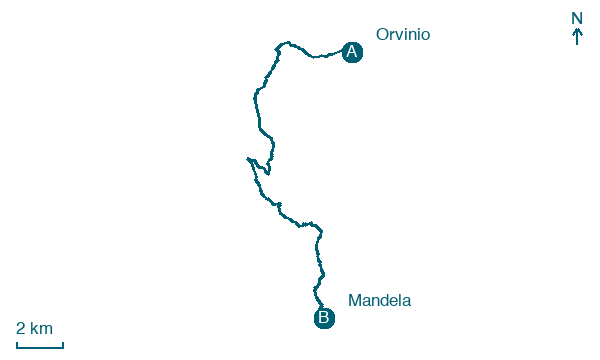
Map · Orvinio → Mandela
Take your walk with you: download Appy
Cammino di San Benedetto: Orvinio → Mandela. Explore maps, stages and elevation in the app, and plan your train or bus journey.

