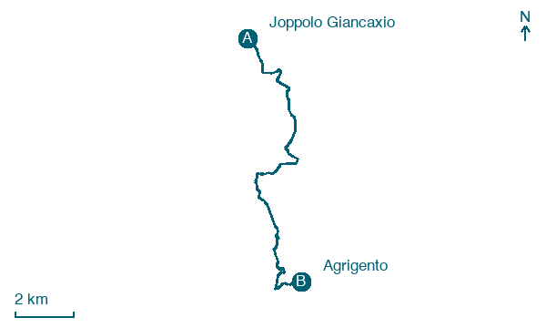
Joppolo Giancaxio → Agrigento
Walking distance 13.7 km
Download Appy for the stage map
Stage information
- Ascent
- 333 m
- Descent
- 296 m
Difficulty: moderate
Walking the stage
Walk 14 km from Joppolo Giancaxio to Agrigento with 333 m of climbing, passing Borsellino and Montaperto.
Before leaving Joppolo Giancaxio, locate Joppolo Castle on the map. It is close to the starting point. On arrival in Agrigento, consider a stop at Santa Maria Addolorata, close to the finish.
Look for these places on the stage map: Borsellino and Montaperto.
What to see on this stage
History and landmarks
Santa Maria Addolorata
< 100 m from the trail as the crow flies
Seventeenth-century church built over an older one, perched on a limestone cliff with its apse partly cut into the rock. Single nave, barrel vault, and home of the Confraternity of the Seven Sorrows, canonically founded on 26 March 1686.
Joppolo Castle
Castle · < 100 m from the trail as the crow flies
Castle, designed by Francesco Paolo Palazzotto, in Joppolo Giancaxio, Italy.
Nature and landscape
Fico magnolioide di Basilica dell'Immacolata - Via Pirandello, Agrigento
Monumental tree · 800 m from the trail as the crow flies
Italy’s monumental tree register identifies this specimen as Ficus macrophylla Desf. ex Pers. It records a height of 9 m and a trunk circumference of 400 cm.
Fico magnolioide di Piazza Aldo Moro, Agrigento
Monumental tree · 1,000 m from the trail as the crow flies
Italy’s monumental tree register identifies this specimen as Ficus macrophylla Desf. ex Pers. It records a height of 9 m and a trunk circumference of 430 cm.
Map · Joppolo Giancaxio → Agrigento
Take your walk with you: download Appy
Magna Via Francigena: Joppolo Giancaxio → Agrigento. Explore maps, stages and elevation in the app, and plan your train or bus journey.

