Ceselli → Spoleto
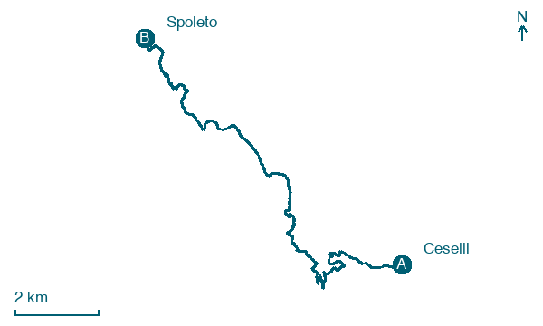
Walking distance 15.7 km
Download Appy for the stage map
Stage information
- Ascent
- 1161 m
- Descent
- 1060 m
Difficulty: challenging
Walking the stage
Walk 16 km from Ceselli to Spoleto with 1161 m of climbing, passing Cese and Civitella, a full day on foot.
On arrival in Spoleto, consider a stop at Crypt of Sant'Isacco, close to the finish.
Look for these places on the stage map: Cese, Collefabbri, Vallocchia, and Testaccio.
What to see on this stage
History and landmarks
Crypt of Sant'Isacco
Church · 200 m from the trail as the crow flies
building with a rectangular shape featuring perimeter walls made of cut stone with regular courses, trusses in the nave, and a ribbed vault in the presbytery
Chiesa dei Santissimi Giovanni e Paolo
Church · 200 m from the trail as the crow flies
building with a rectangular shape featuring perimeter walls made of cut stone with regular courses, trusses in the nave, and a ribbed vault in the presbytery
Nature and landscape
Leccio di Monteluco - Santuario di San Francesco, Spoleto
Monumental tree · < 100 m from the trail as the crow flies
Italy’s monumental tree register identifies this specimen as Quercus ilex L. It records a height of 14.7 m and a trunk circumference of 347 cm.
Roverella di Le Cese - Nevi, Spoleto
Monumental tree · < 100 m from the trail as the crow flies
Italy’s monumental tree register identifies this specimen as Quercus pubescens Willd. It records a height of 19.8 m and a trunk circumference of 495 cm.
Map · Ceselli → Spoleto
Take your walk with you: download Appy
Via di Francesco del Sud: Ceselli → Spoleto. Explore maps, stages and elevation in the app, and plan your train or bus journey.

