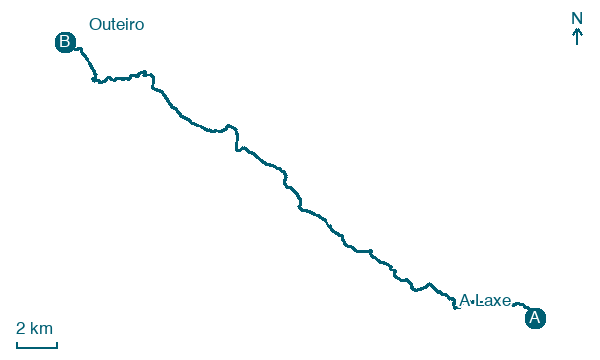
A Laxe → Outeiro
Walking distance 34.4 km
Download Appy for the stage map
Stage information
- Ascent
- 511 m
- Descent
- 691 m
Difficulty: challenging (estimated)
Walking the stage
Cross Silleda on the 34 km from A Laxe to Outeiro, also passing Prado and Eirexe, with 511 m of ascent.
Look for these places on the stage map: Prado, San Fiz, O Portiño, and A Famelga.
What to see on this stage
History and landmarks
Pazo de Liñares
200 m from the trail as the crow flies
Monument, in Q20549421, Spain, designated as bien de interés cultural.
Pazo de Ortigueira
700 m from the trail as the crow flies
Monument in Spanish Baroque style, in Santa Cruz de Ribadulla, Vedra, Spain, designated as cultural heritage.
Nature and landscape
Pico Sacro
Summit · 1.6 km from the trail as the crow flies
Peak at 490 m elevation. Pico Sacro ("Holy Peak" in Galician) is a summit in the central Galician Massif and the municipality of Boqueixón.
Pena Negra
Summit · 500 m from the trail as the crow flies
Map · A Laxe → Outeiro
Take your walk with you: download Appy
Camino Sanabres: A Laxe → Outeiro. Explore maps, stages and elevation in the app, and plan your train or bus journey.

