Deltebre → Sant Carles de la Rápita
Walking distance 33 km
Download Appy for the stage map
Stage information
- Ascent
- 42 m
- Descent
- 35 m
Difficulty: challenging (estimated)
Walking the stage
Walk 33 km from Deltebre through Sant Jaume d'Enveja and el Poblenou del Delta to Sant Carles de la Rápita.
On arrival in Sant Carles de la Rápita, consider a stop at la Torreta, close to the finish.
Look for these places on the stage map: Sant Jaume d'Enveja and el Poblenou del Delta.
What to see on this stage
History and landmarks
Pont del Través
Bridge · 1.1 km from the trail as the crow flies
Raised observation tower and a viewpoint adapted for people with reduced mobility, over the Encanyissada lagoon and the birds of the Ebro Delta. Braille panels were added in 2019.
Torre de Sant Joan
Tower · 1.3 km from the trail as the crow flies
Defence tower raised in 1576 on Philip II's orders against Saracen pirates. Shifting land in the Ebro delta has left its ruined, solid base standing about 50 metres out in the shallow water of the Alfacs bay.
Nature and landscape
la Torreta
Summit · 800 m from the trail as the crow flies
Turó de la Guardiola
Summit · 900 m from the trail as the crow flies
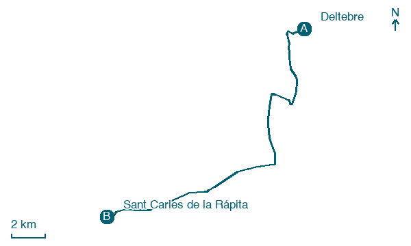
Map · Deltebre → Sant Carles de la Rápita
Take your walk with you: download Appy
Camino Jacobeo del Ebro: Deltebre → Sant Carles de la Rápita. Explore maps, stages and elevation in the app, and plan your train or bus journey.

