Piediluco → Poggio Bustone
Walking distance 22 km
Download Appy for the stage map
Stage information
- Ascent
- 1178 m
- Descent
- 748 m
Difficulty: challenging
Walking the stage
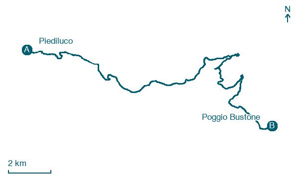
Walk 22 km from Piediluco to Poggio Bustone with 1178 m of climbing, passing Madonna della Luce and Cancello.
Before leaving Piediluco, locate Platano occidentale di Piazza della Resistenza, Terni on the map. It is close to the starting point.
Look for these places on the stage map: Madonna della Luce, Noceta, Le Ettie, and Borgo San Pietro.
What to see on this stage
History and landmarks
Monte Rosato
1.1 km from the trail as the crow flies
Monte Rosato is a peak of the Monti Reatini in Lazio, located in the municipality of Poggio Bustone (province of Rieti). The summit elevation is about 1510 m above sea level and the peak dominates the northeastern edge of the Piana Reatina.
Cima d'Arme
2 km from the trail as the crow flies
Cima d'Arme is a relief of the Monti Reatini located in Lazio, in the province of Rieti, in the municipality of Poggio Bustone.
Nature and landscape
Faggio di Cepparo, Rivodutri
Monumental tree · < 100 m from the trail as the crow flies
Italy’s monumental tree register identifies this specimen as Fagus sylvatica L. It records a height of 8.6 m and a trunk circumference of 290 cm.
Platano occidentale di Piazza della Resistenza, Terni
Monumental tree · < 100 m from the trail as the crow flies
Italy’s monumental tree register identifies this specimen as Platanus occidentalis L. It records a height of 32.5 m and a trunk circumference of 478 cm.
Map · Piediluco → Poggio Bustone
Take your walk with you: download Appy
Via di Francesco di Roma: Piediluco → Poggio Bustone. Explore maps, stages and elevation in the app, and plan your train or bus journey.

