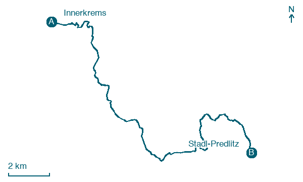
Innerkrems → Stadl-Predlitz
Walking distance 20.6 km
Download Appy for the stage map
Stage information
- Ascent
- 989 m
- Descent
- 787 m
Difficulty: moderate
Walking the stage
Cross 21 km from Innerkrems to Stadl-Predlitz via Schönfeld, Winkl and Turracher Höhe, with 989 m of ascent.
Look for these places on the stage map: Schönfeld, Winkl, and Turracher Höhe.
What to see on this stage
Nature and landscape
Sauereggnock
Summit · < 100 m from the trail as the crow flies
Peak, in Thomatal, Austria, at 2,240 m elevation.
Königstuhl
Summit · < 100 m from the trail as the crow flies
Peak, in Krems in Kärnten, Austria, at 2,336 m elevation.
Map · Innerkrems → Stadl-Predlitz
Take your walk with you: download Appy
Nockberge-Trail: Innerkrems → Stadl-Predlitz. Explore maps, stages and elevation in the app, and plan your train or bus journey.

