Granja de Moreruela → Tábara
Walking distance 25.3 km
Download Appy for the stage map
Stage information
- Ascent
- 504 m
- Descent
- 458 m
Difficulty: challenging (estimated)
Walking the stage
Climb 504 m over 25 km from Granja de Moreruela, passing Faramontanos de Tábara on the way to Tábara.
On arrival in Tábara, consider a stop at Iglesia de Santa María, close to the finish.
Look for these places on the stage map: Finca Val de la Rosa and Faramontanos de Tábara.
What to see on this stage
History and landmarks
Iglesia de Santa María
< 100 m from the trail as the crow flies
Church built over the tower of a monastery where the monks Magius and Emeterius copied and illuminated the Beato de Tábara, dated 970. The room at the base of the tower, entered through a Mozarabic horseshoe arch on columns, is what survives of that monastery.
Monasterio de Santa María de Moreruela
Monastery · 1.4 km from the trail as the crow flies
Ruined Cistercian abbey, perhaps the first Cistercian foundation in Spain, rebuilt by the monks in the twelfth century. Its Romanesque church, 63 m long, keeps the apse complete, with an ambulatory and seven chapels as at Clairvaux.
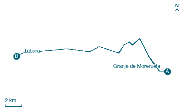
Map · Granja de Moreruela → Tábara
Take your walk with you: download Appy
Camino Sanabres: Granja de Moreruela → Tábara. Explore maps, stages and elevation in the app, and plan your train or bus journey.

