Toscolano → Toscolano
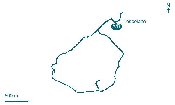
Walking distance 7.2 km
Download Appy for the stage map
Stage information
- Ascent
- 404 m
- Descent
- 415 m
Difficulty: moderate
Walking the stage
This town walk links places of worship associated with Saint Ercolano in the villages on the Brescia side of Lake Garda.
Before leaving Toscolano, locate War memorial on the map. It is close to the starting point.
Look for these places on the stage map: Toscolano Maderno and Maderno.
What to see on this stage
History and landmarks
War memorial
< 100 m from the trail as the crow flies
Ponte vecchio
Bridge · < 100 m from the trail as the crow flies
Nature and landscape
Platano comune di Lungolago Zanardelli, Toscolano-Maderno
Monumental tree · < 100 m from the trail as the crow flies
Italy’s monumental tree register identifies this specimen as Platanus acerifolia (Aiton) Willd. It records a height of 22 m and a trunk circumference of 472 cm.
Cedro del Libano di Parco Bernini - Via Trento, Toscolano-Maderno
Monumental tree · < 100 m from the trail as the crow flies
Italy’s monumental tree register identifies this specimen as Cedrus libani A.Richard. It records a height of 21 m and a trunk circumference of 425 cm.
Map · Toscolano → Toscolano
Take your walk with you: download Appy
Cammino di Sant'Ercolano – Percorso Urbano: Toscolano → Toscolano. Explore maps, stages and elevation in the app, and plan your train or bus journey.

