Mérida → Zafra
Walking distance 0.8 km
Download Appy for the stage map
Stage information
- Ascent
- 9 m
- Descent
- 3 m
Difficulty: easy (estimated)
Walking the stage
Walk this short 1 km link between Mérida and Zafra, which climbs just 9 m along the whole way.
Before leaving Mérida, locate Mérida on the map. It is close to the starting point. On arrival in Zafra, consider a stop at Temple of Diana, close to the finish.
What to see on this stage
History and landmarks
Temple of Diana
< 100 m from the trail as the crow flies
A first-century Roman temple in granite, called Diana's since a seventeenth-century historian named it, though it honoured the emperor. A sixteenth-century palace was built inside its inner room, which helped the temple survive.
Mérida
100 m from the trail as the crow flies
Historic village, in Mérida, Spain, at 241 m elevation.
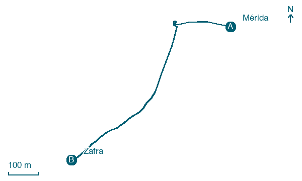
Map · Mérida → Zafra
Take your walk with you: download Appy
Camino Mozarabe (Cordoba): Mérida → Zafra. Explore maps, stages and elevation in the app, and plan your train or bus journey.

