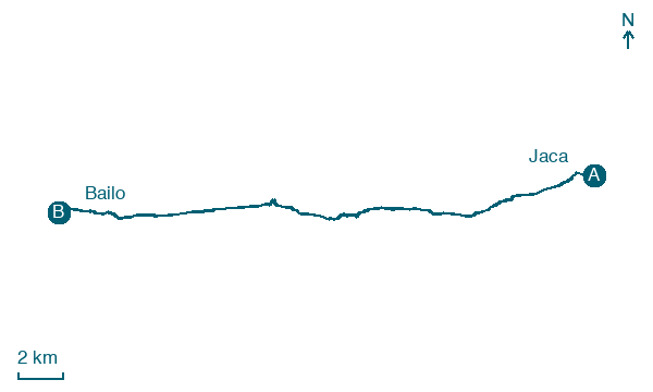
Jaca → Bailo
Walking distance 25.2 km
Download Appy for the stage map
Stage information
- Ascent
- 281 m
- Descent
- 386 m
Difficulty: moderate
Walking the stage
Leave Jaca for Bailo, 25 km via Santa Cilia and Puente la Reina de Jaca, with 281 m of climbing.
Before leaving Jaca, locate Jaca City on the map. It is close to the starting point. On arrival in Bailo, consider a stop at Arrés, close to the finish.
Look for these places on the stage map: La Botiguera, Ascara, Santa Cilia, and Puente la Reina de Jaca.
What to see on this stage
History and landmarks
Arrés
< 100 m from the trail as the crow flies
Historic village, in Bailo, Spain, designated as part of UNESCO World Heritage Site.
Jaca City
< 100 m from the trail as the crow flies
First capital of the kingdom of Aragon, given its charter by Sancho Ramírez in the eleventh century. Its Romanesque cathedral, with chessboard-pattern stonework, and the pentagonal sixteenth-century citadel are the landmarks.
Nature and landscape
Mirasol
Summit · 1.5 km from the trail as the crow flies
Map · Jaca → Bailo
Take your walk with you: download Appy
Camino Aragonés: Jaca → Bailo. Explore maps, stages and elevation in the app, and plan your train or bus journey.

