Cerialdo → Castelletto
Walking distance 19.2 km
Download Appy for the stage map
Stage information
- Ascent
- 212 m
- Descent
- 109 m
Difficulty: easy
Walking the stage
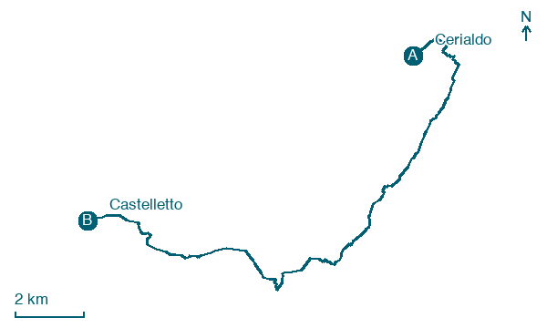
Walk 19 km from Cerialdo to Castelletto, passing Cuneo, San Rocco Castagnaretta and Mellana, with 212 m of climbing.
Look for these places on the stage map: Cuneo, Mellana, Borgo San Dalmazzo, and Roccasparvera.
What to see on this stage
History and landmarks
Cappella della Madonna delle Grazie
Church · < 100 m from the trail as the crow flies
Cappella di S. Bernardo
Church · < 100 m from the trail as the crow flies
Nature and landscape
Parco fluviale Gesso e Stura
National park · 1.9 km from the trail as the crow flies
Gesso and Stura River Park. 21st-century national park, in Castelletto Stura, Italy, covering 365.0 km².
Pioppo bianco di Viale degli Angeli 77, Cuneo
Monumental tree · < 100 m from the trail as the crow flies
Italy’s monumental tree register identifies this specimen as Populus alba L. It records a height of 27.5 m and a trunk circumference of 428 cm.
Map · Cerialdo → Castelletto
Take your walk with you: download Appy
Via di Sant'Anna: Cerialdo → Castelletto. Explore maps, stages and elevation in the app, and plan your train or bus journey.

