San Gimignano → Monteriggioni
Walking distance 31.3 km
Download Appy for the stage map
Stage information
- Ascent
- 741 m
- Descent
- 795 m
Difficulty: moderate
Walking the stage
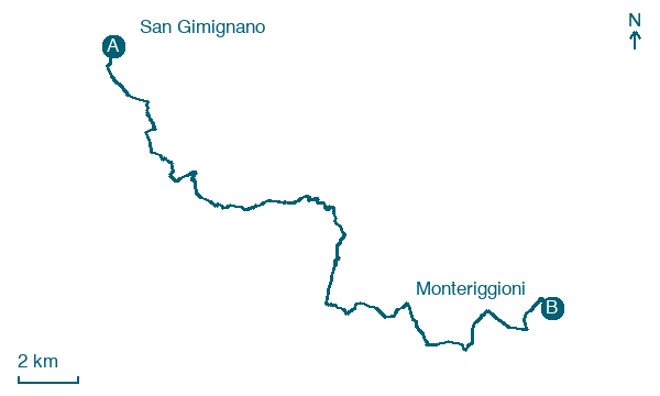
Walk 31 km from San Gimignano to Monteriggioni with 741 m of climbing, passing Campiglia dei Foci and Colle di Val d'Elsa.
Before leaving San Gimignano, locate TORRE DEGLI ARDINGHELLI on the map. It is close to the starting point.
Look for these places on the stage map: Campiglia dei Foci and Colle di Val d'Elsa.
What to see on this stage
History and landmarks
TORRE DEGLI ARDINGHELLI
Tower · < 100 m from the trail as the crow flies
Buildings with a trapezoidal plan; vertical structures in brick and stone; flat roof.
Santa Maria delle Grazie
< 100 m from the trail as the crow flies
Fifteenth-century oratory built by the Luci brothers, turned into a convent in 1501. Its gabled brick front has a small round window wreathed in a Robbian-style ceramic garland, and inside are sixteenth-century Florentine frescoes and a brick Renaissance cloister.
Map · San Gimignano → Monteriggioni
Take your walk with you: download Appy
Romea Strata Italiana: San Gimignano → Monteriggioni. Explore maps, stages and elevation in the app, and plan your train or bus journey.

