Vicenza → Barbarano
Walking distance 20.8 km
Download Appy for the stage map
Stage information
- Ascent
- 69 m
- Descent
- 98 m
Difficulty: easy
Walking the stage
Follow an easy 21 km stretch from Vicenza to Barbarano, passing Longare, Debba and Secula.
Before leaving Vicenza, locate Platano orientale di Viale Antonio Giuriolo, Vicenza on the map. It is close to the starting point.
Look for these places on the stage map: Longare, Debba, Secula, and Costozza.
What to see on this stage
Nature and landscape
Platano orientale di Viale Antonio Giuriolo, Vicenza
Monumental tree · < 100 m from the trail as the crow flies
Italy’s monumental tree register identifies this specimen as Platanus orientalis L. It records a height of 23.8 m and a trunk circumference of 347 cm.
Sequoia gigante di Piazza Matteotti, Vicenza
Monumental tree · < 100 m from the trail as the crow flies
Italy’s monumental tree register identifies this specimen as Sequoiadendron giganteum (Lindl.) J. Buchholz. It records a height of 16 m and a trunk circumference of 260 cm.
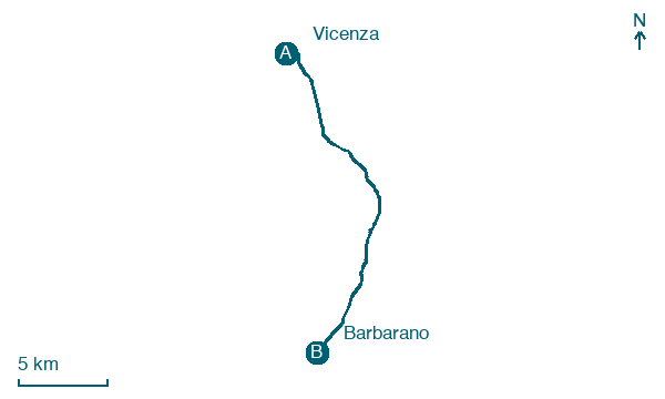
Map · Vicenza → Barbarano
Take your walk with you: download Appy
Romea Vicetia: Vicenza → Barbarano. Explore maps, stages and elevation in the app, and plan your train or bus journey.

