Irún → San Sebastián
Walking distance 24.5 km
Download Appy for the stage map
Stage information
- Ascent
- 782 m
- Descent
- 801 m
Difficulty: moderate (estimated)
Walking the stage
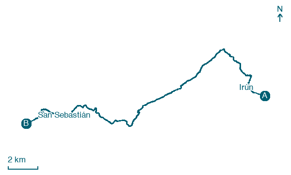
Begin the Camino del Norte with 24 km from Irún to San Sebastián, via Hondarribia and Pasaia, with 782 m of ascent.
Before leaving Irún, locate Camino de Santiago de la Costa on the map. It is close to the starting point.
Look for these places on the stage map: Belaskoenea, Lezo, Herrera, and Marrutxipi.
What to see on this stage
History and landmarks
Camino de Santiago de la Costa
< 100 m from the trail as the crow flies
The coastal branch of the Camino de Santiago, over 800 km from Irún along northern Spain's shore, in parts on the old Roman road Via Agrippa. Quieter and harder than the French Way for its climbs, with shelters every 20 to 35 km and cooler summers by the sea.
Villaviciosa jauregia
Palace · < 100 m from the trail as the crow flies
Palace in Renaissance style, in Pasaia, Spain, designated as Basque government heritage site.
Nature and landscape
Plaiaundi
National park · 500 m from the trail as the crow flies
National park in Spain. The Plaiaundi Ecology Park is a 24-hectare coastal wetland lying where the Bidasoa River meets the sea in the Bay of Biscay.
Acantilados de Ulia
National park · 400 m from the trail as the crow flies
Map · Irún → San Sebastián
Take your walk with you: download Appy
Camino del Norte: Irún → San Sebastián. Explore maps, stages and elevation in the app, and plan your train or bus journey.

