Ponte Tresa → Ganna
Walking distance 14.1 km
Download Appy for the stage map
Stage information
- Ascent
- 362 m
- Descent
- 166 m
Difficulty: moderate
Walking the stage
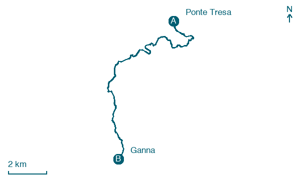
Cover 14 km from Ponte Tresa to Ganna, climbing 362 m, passing Lavena and Cugliate, a short stage.
On arrival in Ganna, consider a stop at Lago di Ganna, close to the finish.
Look for these places on the stage map: Lavena, Campaccio, Ghetto, and Ca' di Sopra.
What to see on this stage
History and landmarks
Chiesa di S. Gemolo
Church · < 100 m from the trail as the crow flies
Badia di S. Gemolo
Abbey · < 100 m from the trail as the crow flies
Nature and landscape
Lago di Ghirla
Lake · 100 m from the trail as the crow flies
Lake Ghirla. Lake, dedicated to Ghirla, in Italy, at 442 m elevation.
Lago di Ganna
Lake · 700 m from the trail as the crow flies
Lake Ganna. Lake, dedicated to Ganna, in Valganna, Italy, at 452 m elevation, covering 0.1 km².
Map · Ponte Tresa → Ganna
Take your walk with you: download Appy
Via Francisca del Lucomagno: Ponte Tresa → Ganna. Explore maps, stages and elevation in the app, and plan your train or bus journey.

